
Get to know the first 4.5 K of the Hasetsune Cup course.
| Distance | 4.5K |
| Elevation Gain | 350m |
| Elevation Drop | 80m |
The Start: the Jr High Ground
The race starts at the junior high ground. Using the honor system, you line up based on your own projected finish time.
After a couple welcome speeches, the gun goes and the walk in the corral to the start line commences. A few minutes later, you are on the road.
The start takes you to a right on the main road, then a quick left to descend to the Aki River. Once across the river, a right at the T, and then the first hill begins.
Since it is at the start and legs are fresh, many try to run this hill. Unless you are going for a podium/age group place/etc, the smart move would be to hike at least the middle part.
Though it is a good warmup, the only reason mere mortals would be forgiven for running this hill is to avoid the inevitable bottleneck at the trailhead. This was more of a problem in the late 2010s. Since then, clever trail maintenance has alleviated the worst of the slowdown.
Temple at the Trailhead
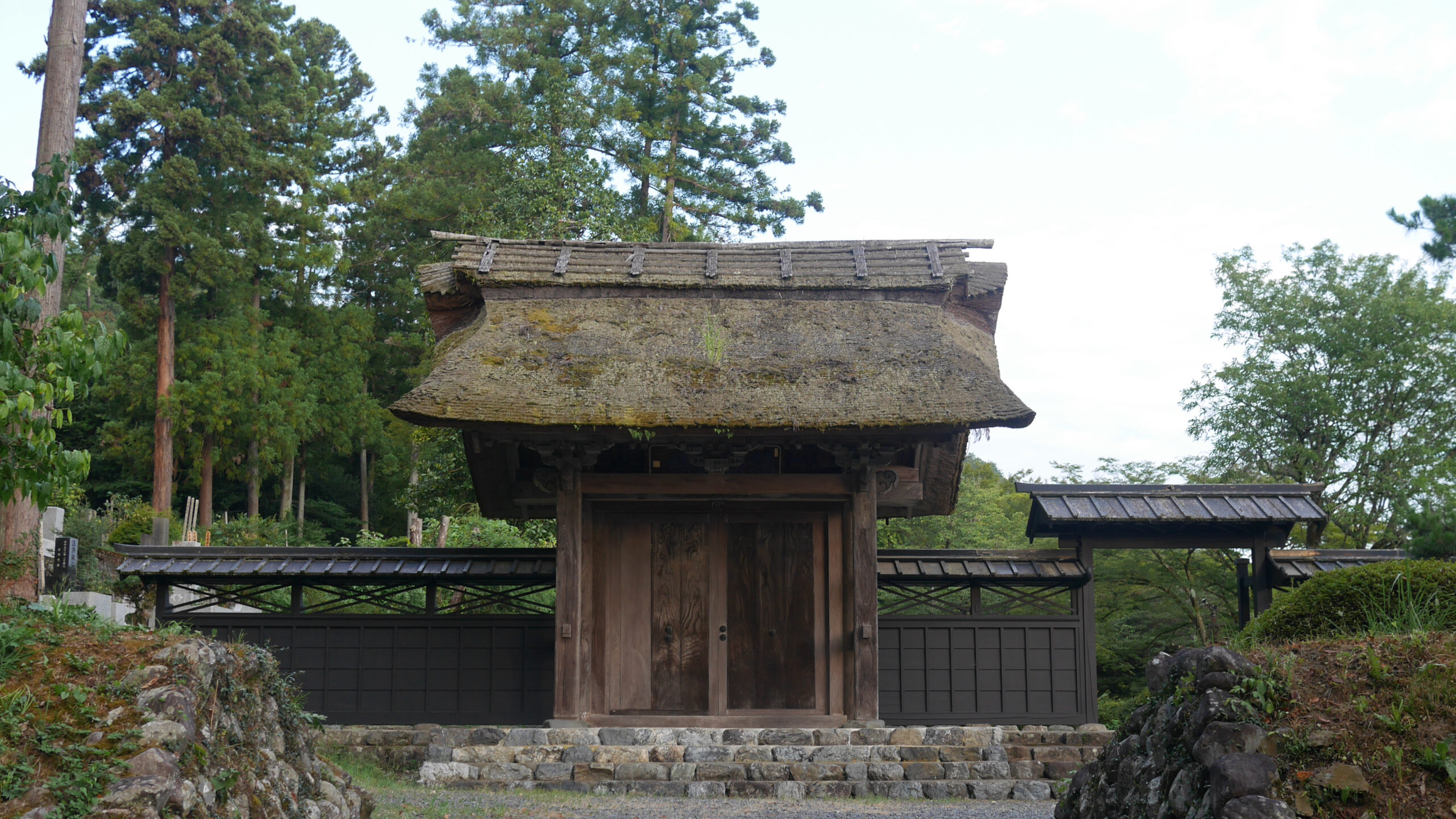
At the top of the hill you reach the entrance to a temple named 広徳寺 – Kotokuji. On race day there is a festival atmosphere with taiko drums playing.

Kotokuji was founded in 1373, in the latter half of the Nanboku-cho Period. The majority of the buildings on the grounds date from the Edo period – the impressive temple gate was built in 1720, the bell tower in 1759, the main hall and kyozo (repository for religious texts) in later 1700s, and the main gate in the early 1800s.
Turn left up the trail and wind through the trees. As the forest opens there is a nice view of Musashi Itsukaichi to the left. Trail maintenance in 2018-2019 cleared up what used to be a terrible bottleneck just after this view.
Imakuma Shrine

The trail is short-lived and soon spits you out onto a road orbiting an electricity plant. After you descend a deceptively slick road, you take a sharp right up to the lower buildings of Imakuma Shrine. The trail goes up the stairs through the torii. There are toilet facilities to the left past the torii before the stairs rise from the road.
A long uphill ensues, with a handful of switchbacks. Two-thirds up there is a viewpoint again over the town. From there it is a short climb to another landing with a permanent toilet facility.

Related Links
How to Get Out to the Tokyo Mountains
How to Read Hasetsune Trail Markers
ハセツネ – Hasetsune
https://www.hasetsune.jp/ (Official Site)
More in this series
- Hasetsune Course: Mt Hinode to Itsukaichi Hall

- Hasetsune Course: Mt Mitake To Mt Hinode

- Hasetsune Course: Mt Otake to Mt Mitake

- Hasetsune Course: Odawa to Mt Otake

- Hasetsune Course: Mt Gozen to Odawa

- Hasetsune Course: Tsukiyomi Parking to Mt Gozen

- Hasetsune Course: Mt Mito to Tsukiyomi Parking

- Hasetsune Course: Saibara Pass to Mt Mito

- Hasetsune Course: Maruyama to Saibara Pass

- Hasetsune Course: Sengen Pass to Maruyama

- Hasetsune Course: Mt Mikuni to Sengen Pass

- Hasetsune Course: Daigomaru to Mt Mikuni

- Hasetsune Course: Mt Ichimichi to Daigomaru

- Hasetsune Course: Iriyama Pass to Ichimichi Turn

- Hasetsune Course: Mt Imakuma To Iriyama Pass

- Hasetsune Course: Start to Mt Imakuma

- How to Read Hasetsune Trail Markers

- The Hometown of Japan Trailrunning – Musashi Itsukaichi

